From Dolina Jalovecká trought Baníkov to Žiarska dolina (valley)
Ústie Jaloveckej doliny – ústie Bobroveckej doliny 1 1⁄4 h – ústie Hlbokej doliny 1⁄2 h – Baníkovské sedlo 2 h – Baníkov 1⁄4 h – Jalovecké sedlo 3⁄4 h – Žiarska chata 1 h – ústie Žiarskej doliny 1 h Spolu: 6 3⁄4 h
Mouth of Jalovecká dolina (valley) – mouth of Bobrovecká dolina (valley) 1 1⁄4 hrs – mouth of Hlboká dolina (valley) 1⁄2 hrs – Baníkovské sedlo (saddle) 2 hrs – Baníkov 1⁄4 hrs – Jalovecké sedlo (saddle) 3⁄4 hrs – Žiarska chata (chalet) 1 hr – mouth of Žiarska dolina (valley) 1 hr Total: 6 3⁄4 hrs
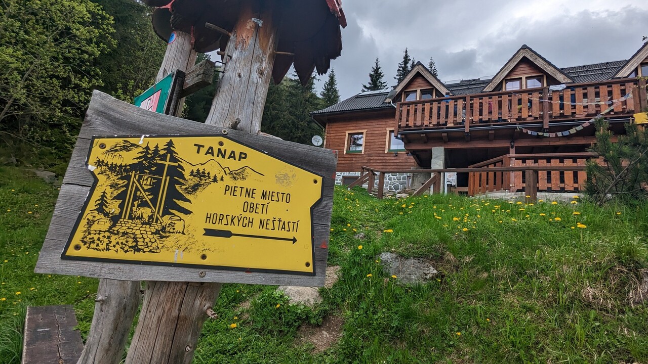
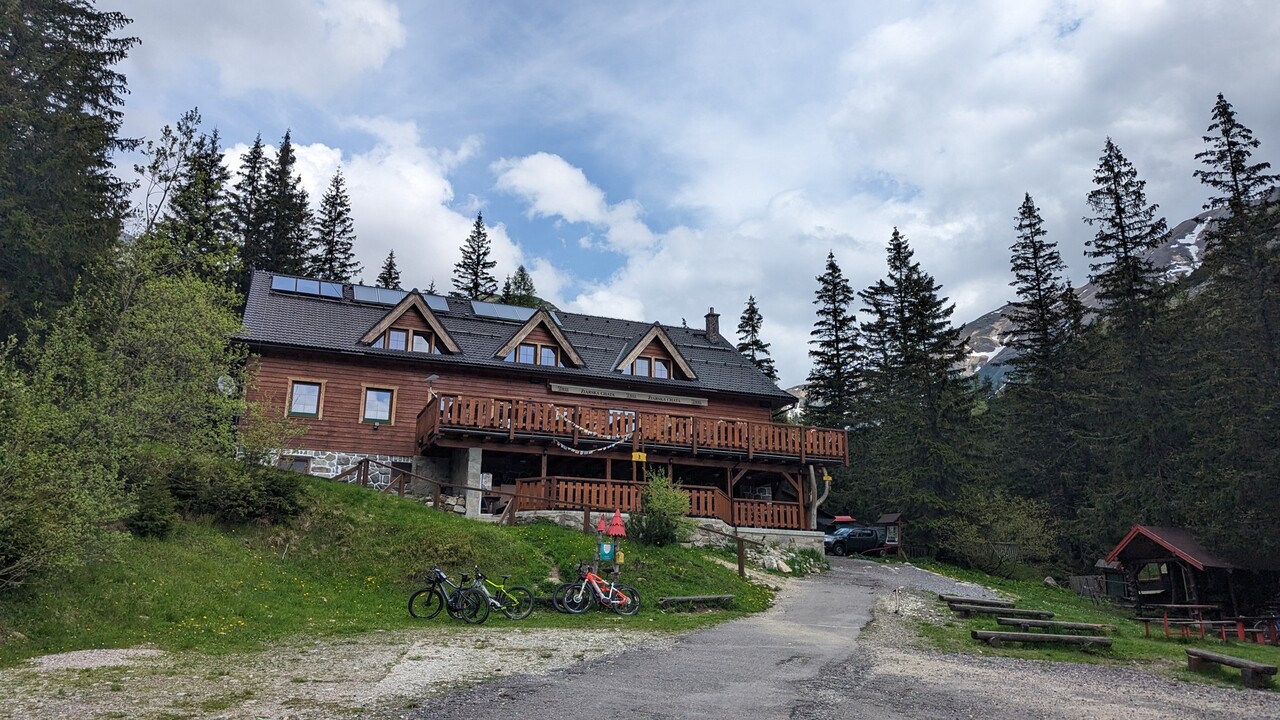
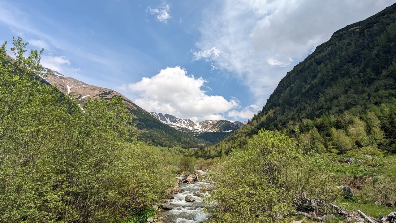
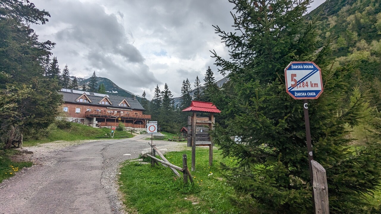
You´ll get to the mouth of Jalovecká valley (800 m) from the village of Jalovec taking a yellow trail (8617) or from a parking place Bobrovecká vápenica alongside a mountain hotel Mních, where you´ll meet the yellow trail. You can continue from a crossroad at Tokariny still along the yellow trail which, in the certain section, collides with the red mountain trail (0860). At the road post, placed at the mouth of the valley turn left on the yellow trail and keep the left side of the creek to the Jalovecká valley. Then cross the tributary stream of the creek and continue along the forest path. Later climb up the path leading you from the bottom of the valley along its left slope. Continue along the traverse and return again to the stream. Cross several wooden bridges mildly ascending to the resting place in front of a long wooden footbridge and you´ll find yourself at the mouth of the Bobrovecká valley (1.005 m) and the valley Parichvost. After the footbridge take the blue (2710) and green (5611) marked trails leading to the valley Parichvost. Cross the wooden bridges and you will get to the left side of the valley. The maintained path will lead you out the forest (approx. 1 hour) to turn on the green marked trail at the mouth of the Hlboká valley (1.130 m). Continue along the blue trail, cross the bridge on the left side of the valley and climb steeply through the forest to a dwarf pine zone. Return once again to the river and go to the other side. Climb the steep serpentine path leading through pines and rocky ribs and continue along the longer traverse down the rocky couloir and grassy slope to the left to Baníkovské saddle (2.040 m). Here turn right and follow the red marked ridge trail (0862) which will lead you through a steep and sporadically exposed ridge to underneath the top rib. Then head to the highest point of the route - Baníkov (2.178 m). From its summit you can admire the beautiful panoramic view of dominants of the regions Orava, Liptov and Tatras. After a short rest on the peak of Baníkov take the green trail (5610) which is leading along the southern rib towards a shallow saddle. From the saddle climbing the exposed rocky ridge you´ll get to the second highest point of the route – the Príslop peak (2.142 m). Continue southwards over the rocky, later expanding grassy slope to the Jalovecké saddle (1,858 m). From the marks will lead us to the eastern slope with first islands of dwarf pine trees. Descend through serpentines into the couloir to get down along the left side. Underneath the waterfall (Šarafiový vodopád) traverse left into the couloir. Through the creek flowing left you´ll meet the maintained path. The path will lead you to the piety place of victims of mountain accidents in the West Tatras. From there go alongside the Mountain Rescue Service towards the Žiarska chalet (1.300 m) and with a comfortable descent down the Žiarska valley you can end your trip at the bus stop just below the mouth of Žiarska valley (880 m).
48. The mouth of Račková dolina (valley) – Jakubiná - The mouth of Račková dolina (valley)
Račková valley – a branching of Račková and Jamnícka valleys – a chalet at the hill Prostredná - an intersection in Gáborová valley – mountain lakes in Račková valley - Račková saddle - Končistá – Hrubý vrch (a hill) - Jakubiná - Hrubý vrch (a hill) – an intersection in Jamnícka valley – branching of Račková and Jamnická valley – the mouth of Račková valley.
The route starts with a gently ascending wide path that will lead you to the intersection of Račková and Jamnická valleys. Then a sharp serpentine climb will direct you up on a forest path. The forest zone is followed by a mountain pine area that offers us beautiful views. Jamnická valley, behind which the mountain Baranec rises, is seen on the left. On the right you can see the Račková valley with Bystrá. Along the demanding and ascending path full of rock formations you´ll get to the top of Jakubiná. From it you can enjoy a wonderful view of the Tatras hills and valleys. After this little break spent admiring the mountains and relaxing go through the saddle up the hill Hrubý vrch.
6 h 45 m
Duration
18km
Length
Jalovecká dolina
Starting point
Baníkov
End point
1446m
Total ascent
1406m
Total descent